
3D Laser Scanning for accurate crash reconstruction
3D Laser Scanning for accurate crash reconstruction
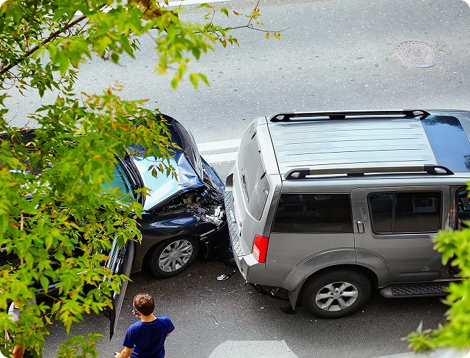
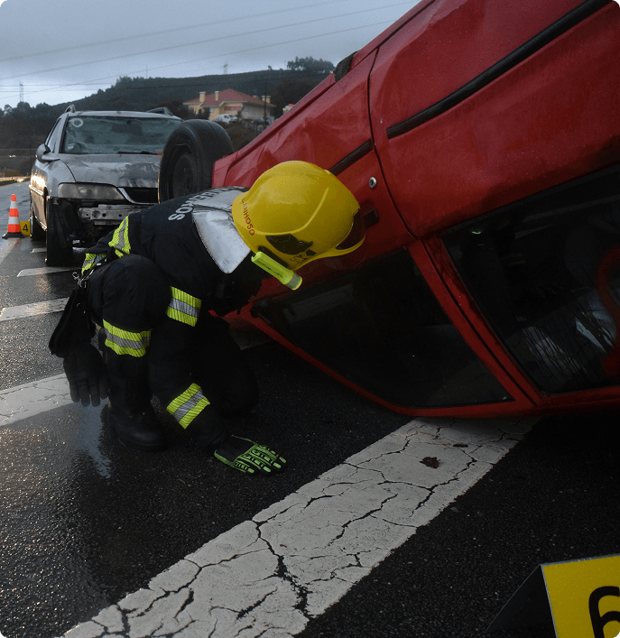
Crash reconstruction requires accuracy and quick decision-making. You have to work quickly to gather evidence while also managing traffic, keeping your team safe, and making sure every measurement is precise. Traditional methods like using tape measures, protractors, and manual photography leave you vulnerable on busy roads for long periods of time, putting everyone at risk.
3D laser scanning completely changes this situation.
This advanced investigation technology allows you to capture entire crash scenes in just a few minutes instead of hours. It creates detailed 3D models that preserve every important detail. With this technology, you can document vehicle damage, skid marks, debris fields, and environmental factors with stunning realism—all without spending excessive time exposed to traffic dangers. Plus, the accuracy of this technology is remarkable, measuring down to the millimeter while significantly reducing the time spent at the scene.
3D technology for accurate crash reconstruction isn’t just faster—it’s fundamentally better. You can revisit the scene virtually, take measurements you didn’t know you’d need, and present compelling visual evidence that helps juries understand complex collision dynamics. The days of incomplete documentation and guesswork
are over.
Challenges in Traditional Crash Scene Documentation
Traditional crash scene documentation puts investigators in difficult and dangerous positions.
Manual Measurements
When you’re working with manual measurements:
- Every skid mark needs to be measured by hand
- Every piece of debris requires documentation with tape measures
- Angles must be calculated using protractors
This process can take hours—sometimes an entire day for complex scenes—while traffic backs up and the risk of secondary incidents increases.
Roadside Investigation Risks
The roadside investigation risks are significant and constant:
- You're working alongside active traffic lanes where vehicles pass at high speeds
- Often, vehicles are just feet away from where you're crouching to photograph evidence or stretching measuring tapes across the roadway
Traffic control becomes a critical safety concern, requiring additional personnel and resources just to create a buffer zone that’s never truly safe.
Human Error
Human error compounds these challenges in multiple ways:
- Measurements can be recorded incorrectly or transposed during documentation
- Evidence might be missed entirely during the initial walk-through
- Photographs may not capture the right angles or details needed later
- Weather conditions can deteriorate evidence quality before documentation is complete
- Fatigue sets in during lengthy scene processing, affecting accuracy
Once the scene is cleared and traffic resumes, you can’t go back. Any missed measurements or overlooked evidence is lost permanently, potentially compromising the entire reconstruction.
This pressure to capture everything correctly the first time—while managing safety concerns and time constraints—creates an environment where mistakes become almost inevitable.
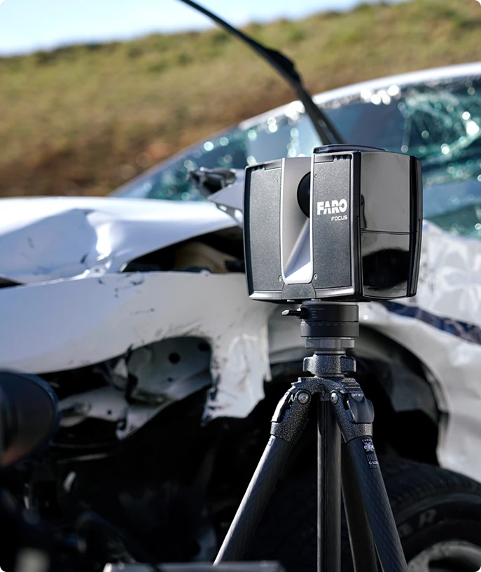
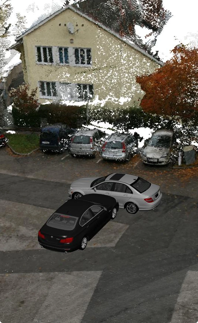
The Role of 3D Laser Scanning in Crash Reconstruction
3D laser scanning has revolutionized crash scene investigation, making it faster and more efficient. Instead of relying on manual methods like tape measures and cameras, investigators can now use this technology to quickly capture detailed information about the scene.
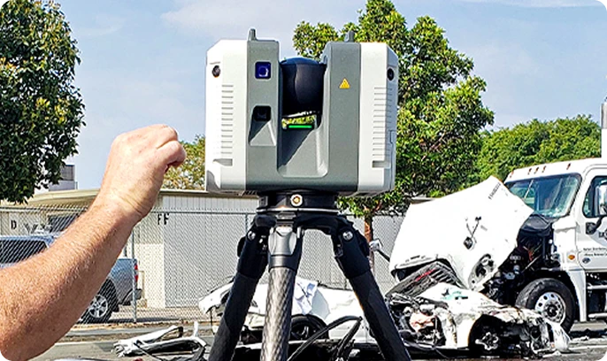
How 3D Laser Scanning Works
The technology behind 3D laser scanning involves sending out laser pulses that bounce off surfaces and create precise measurements. These measurements are then used to create a three-dimensional representation of the crash site, known as a point cloud.
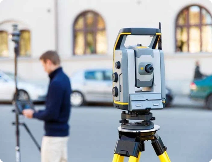
Advantages of 3D Laser Scanning in Crash Reconstruction
Speed and Efficiency
With traditional methods, documenting a crash scene can be time-consuming and may require multiple investigators working simultaneously. However, with 3D laser scanning, a single operator can capture all the necessary data in a fraction of the time.
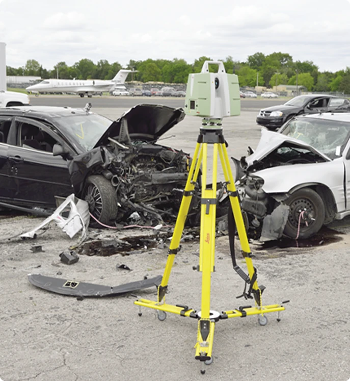
Accuracy
The Artec3d Focus Scanner and other similar devices are capable of capturing crash scenes with millimeter-level accuracy. This level of precision is crucial for reconstructing accidents and understanding the dynamics involved.
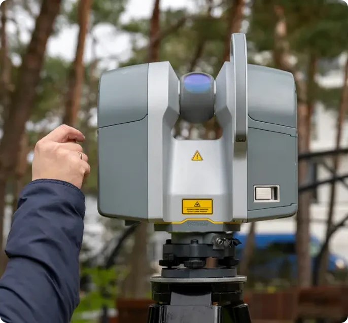
Comprehensive Documentation
Unlike traditional methods that may only provide limited views or specific measurements, 3D laser scanning offers a complete representation of the scene. This includes details such as tire marks, debris patterns, guardrail damage, and road surface conditions.
Flexibility in Analysis
The digital nature of the data collected through scanning allows for greater flexibility in analysis. Investigators can revisit the scene virtually weeks or months later, measure distances between points, calculate angles, and examine evidence from different perspectives.
Enhanced Visualization
Photorealistic models generated from scan data provide an immersive experience that traditional methods cannot match. These models allow stakeholders to better understand the crash dynamics and communicate findings effectively.
Conclusion
3D laser scanning has transformed the way crash scenes are investigated and reconstructed. Its speed, accuracy, comprehensive documentation capabilities, flexibility in analysis, and enhanced visualization make it an invaluable tool for accident reconstruction professionals.
Step-by-Step Process Using 3D Technology for Crash Investigation
Traditional crash scene documentation puts investigators in difficult and dangerous positions.
1. Capturing On-Scene Evidence Efficiently with Handheld Scanners
The Artec3d Freestyle 2 Handheld Scanner represents a significant advancement in vehicle damage documentation during crash investigations. You can walk around a vehicle and capture every detail of both interior and exterior damage in minutes, creating a comprehensive digital record that would traditionally require hours of manual measurements and photography.
When you arrive at a crash scene, time is critical. The Artec3d Freestyle 2 allows you to scan an entire vehicle—including crushed panels, broken glass, deployed airbags, and interior deformation—in approximately 5 to 10 minutes. This handheld device operates without the need for targets or extensive setup, meaning you can begin capturing data immediately upon arrival.
The scanner’s portability gives you unprecedented flexibility in 3D technology for accurate crash reconstruction. You can maneuver the device into tight spaces, under vehicles, and around complex damage patterns that would be difficult to document with stationary scanning equipment. The real-time visualization on the device’s screen lets you verify coverage as you scan, ensuring you don’t miss critical evidence before leaving the scene.
- You're working alongside active traffic lanes where vehicles pass at high speeds
- Often, vehicles are just feet away from where you're crouching to photograph evidence or stretching measuring tapes across the roadway
Traffic control becomes a critical safety concern, requiring additional personnel and resources just to create a buffer zone that’s never truly safe.
Key advantages of handheld scanning for crash investigation include:
- Speed: Complete vehicle scans in under 10 minutes versus 30-60 minutes with manual methods
- Safety: Reduced exposure time for investigators working near active traffic
- Completeness: Capture millions of data points that traditional tape measures and cameras cannot record
- Flexibility: Document hard-to-reach areas like undercarriages and collapsed interiors
- Immediate verification: Real-time feedback ensures comprehensive coverage before scene departure
The technology excels at capturing intricate damage patterns that tell the story of impact forces and vehicle dynamics. You can document the exact depth of door intrusions, the precise angle of steering column displacement, or the specific deformation of roof pillars—all measurements that become crucial during reconstruction analysis.
Scene scanning time reduction directly translates to improved safety for both investigators and the traveling public. Roads reopen faster, reducing the risk of secondary crashes and minimizing traffic disruption. The Artec3d Freestyle 2 Handheld Scanner achieves this
2. Preparing and Securing Data for Analysis: Ensuring Integrity and Security
Once you’ve captured crash scene data with your Artec3d Freestyle 2 Handheld Scanner, protecting that information becomes your next priority. The scanner’s automatic saving feature works continuously during your investigation, eliminating the risk of losing critical vehicle damage documentation due to battery failure or
unexpected interruptions.
Data integrity is crucial when building a case that may go to court. Modern 3D technology for accurate crash reconstruction includes built-in verification systems that check file completeness before you leave the scene. You can transfer your scan data directly from the Artec3d Freestyle 2 Handheld Scanner to your laptop or secure cloud storage through encrypted connections, ensuring no information gets corrupted or compromised during the transfer process.
The scanner creates timestamped files that maintain a clear chain of custody for your evidence. You’ll appreciate how the system automatically backs up your vehicle damage documentation to multiple locations, giving you redundancy that traditional photography methods simply can’t match. This dual-layer protection means your investigation data remains accessible and unaltered from capture through final analysis.
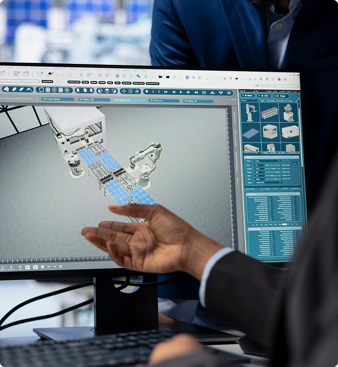
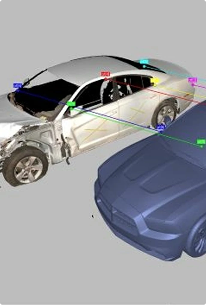
3. Processing and Managing Complex Crash Data: Merging Sources and Enhancing Reports with Artec3d Software Tools
The Artec3d SCENE2GO app transforms raw scan data into actionable intelligence for crash reconstruction professionals. This mobile-friendly platform consolidates information captured by the Artec3d Freestyle 2 Handheld Scanner alongside terrestrial laser scanner data, creating unified digital reconstructions that represent the complete crash scene. You can merge point clouds from multiple scanning positions, combine aerial drone imagery with ground-level scans, and integrate traditional photographs into a single cohesive model.
The software’s annotation capabilities allow you to embed critical details directly into your 3D Technology for accurate crash reconstruction models. You can attach investigative notes to specific damage points on vehicles, link witness statements to precise locations within the scene, and incorporate time-stamped videos showing vehicle damage documentation from various angles. This layered approach to data management means your crash investigation files become comprehensive digital case folders rather than scattered collections of measurements and photos. The app’s intuitive interface requires minimal training, letting you focus on analysis rather than wrestling with complex software workflows.
4. Analyzing Data and Creating Detailed Diagrams: From Scan Data to Immersive Visualizations with Artec3d Zone Software
Artec3d Software transforms raw point cloud data into actionable intelligence for crash reconstruction specialists. You can manipulate the captured data from your Artec3d Freestyle 2 Handheld Scanner within an intuitive interface, measuring critical distances, angles, and elevations with precision that manual methods simply cannot match.
The software allows you to create professional diagrams directly from your 3D Technology for accurate crash reconstruction data. You’ll extract measurements for vehicle damage documentation, generate cross-sections of the crash scene, and produce scaled overhead views that clearly illustrate vehicle positions and trajectories. These visualizations help you identify impact points, calculate speeds, and determine sight lines with confidence.
Artec3d Software enables you to build immersive fly-through animations that transport viewers directly into the reconstructed scene. You can add annotations, highlight specific evidence points, and create multiple viewing perspectives that tell the complete story of the investigation. The software’s rendering capabilities produce photorealistic representations that make complex spatial relationships immediately understandable to attorneys, judges, and jury members.

Benefits of Using 3D Laser Scanning in Legal Proceedings
Enhancing Court Presentations with Forensic Software Tools
The courtroom becomes a different place when you introduce 3D laser scanning evidence. Traditional crash reconstruction reports often struggle to convey the complexity of collision dynamics to juries who lack technical expertise. Forensic software transforms raw scan data into compelling visual narratives that jurors can actually understand.
You can create fly-through videos that place jury members directly at the crash scene, allowing them to experience the spatial relationships between vehicles, roadway features, and impact points. These animations demonstrate collision sequences from multiple perspectives, making abstract concepts like velocity vectors and impact angles tangible. Both defense attorneys and prosecutors benefit from this clarity—you’re not asking jurors to imagine the scene, you’re showing them exactly what happened.
Measurable Impact on Case Outcomes
The impact on case outcomes is measurable. Many cases settle before trial when opposing counsel reviews the detailed 3D evidence. The precision of laser scanning data leaves little room for competing interpretations, and the photorealistic visualizations make discrepancies in witness testimony immediately apparent. Court presentations featuring 3D reconstructions carry substantial weight because they’re based on millions of measured data points rather than subjective observations.
You’ll find that judges increasingly accept 3D scan data as admissible evidence, recognizing its scientific foundation and accuracy standards. The technology’s ability to preserve the scene exactly as it existed at the time of investigation provides an unimpeachable record that withstands cross-examination.
Real-Life Feedback from Investigators Implementing 3D Solutions: Improved Accuracy, Reduced Scene Time, User-Friendly Technology
Law enforcement agencies across the country have shared compelling investigator testimonials about their experiences with 3D technology for accurate crash reconstruction. Traffic units report dramatic reductions in scene time—what once took hours of manual measurements now requires just 15-30 minutes with handheld scanners. Investigators particularly appreciate the confidence they gain when testifying, knowing their data captures every detail with millimeter-level precision.
The technology’s intuitive interface has eliminated the steep learning curve many agencies feared. Investigators who initially hesitated to adopt digital tools now describe the scanning process as straightforward and reliable. One traffic reconstruction specialist noted that the ability to revisit the scene virtually has transformed their analysis capabilities, allowing them to discover evidence they might have missed during initial on-scene documentation.
Case quality has improved measurably. Agencies report fewer challenges to their findings during depositions and court proceedings. This can be attributed to the comprehensive nature of 3D data, which leaves little room for speculation about scene conditions or vehicle positions.
Conclusion
3D technology for accurate crash reconstruction has fundamentally changed how you approach crash scene investigations. The shift from tape measures and manual photography to laser scanning represents more than just a technological upgrade—it’s a complete transformation of your investigative capabilities.
You’ve seen how handheld scanners capture detailed evidence in minutes rather than hours. You understand the value of creating photorealistic digital twins that preserve every critical detail of a crash scene. The data you collect now serves multiple purposes: immediate analysis, long-term case review, and compelling courtroom presentations that help juries visualize exactly what happened.
The feedback from investigators speaks volumes. You’re spending less time exposed to traffic dangers on roadside scenes. Your reports contain richer, more defensible evidence. The learning curve for these tools is manageable, and the return on investment shows up in every case you work.
The technology continues evolving, with improvements in scanner portability, software capabilities, and data processing speeds. If you’re still relying on traditional methods, you’re working harder than necessary while collecting less comprehensive evidence. The question isn’t whether to adopt 3D laser scanning—it’s how quickly you can integrate these tools into your crash reconstruction workflow.
Frequently Asked Questions
What are the main challenges in traditional crash scene documentation?
Terrestrial Laser Scanning (TLS) is a ground-based LiDAR technology that rapidly captures millions of precise 3D data points to create highly accurate 3D models, photorealistic images, and detailed real-time measurements of physical objects, structures, and environments. It works by spinning a laser to measure distances and angles to surfaces, producing dense “point clouds” for applications like construction, forensics, heritage conservation, and infrastructure inspection.
How does 3D laser scanning improve the accuracy and efficiency of crash reconstruction?
TLS captures millions of data points in a single scan, delivering highly accurate and precise measurements. The latest devices ensure +-1mm accuracy of the single scan, this level of detail is invaluable for creating as-built models, conducting topographic surveys, and ensuring design accuracy. It eliminates human error, and the measurement inaccuracies are often associated with traditional surveying methods. TLS captures millions of data points in a single scan, providing highly accurate and precise measurements. The latest devices ensure +/-1mm accuracy of each scan, and this level of detail is invaluable for creating as-built models, conducting topographic surveys, and ensuring design precision.
What is the step-by-step process of using 3D technology for crash investigation?
Yes, we offer industrial as-built services, documenting final dimensions, locations of equipment, pipes, conduits, and changes from original plans for warehouses, manufacturing, and large facilities. These deliverables (drawings/models) ensure compliance, facilitate maintenance, and aid future renovations.
How can 3D laser scanning technology benefit legal proceedings in crash cases?
Yes, we offer industrial as-built services, documenting final dimensions, locations of equipment, pipes, conduits, and changes from original plans for warehouses, manufacturing, and large facilities. These deliverables (drawings/models) ensure compliance, facilitate maintenance, and aid future renovations.
What feedback have investigators provided regarding the use of Artec3d scanners and software in crash reconstruction?
Yes, we offer industrial as-built services, documenting final dimensions, locations of equipment, pipes, conduits, and changes from original plans for warehouses, manufacturing, and large facilities. These deliverables (drawings/models) ensure compliance, facilitate maintenance, and aid future renovations.
Why is maintaining data integrity important during 3D crash investigation analysis?
Yes, we offer industrial as-built services, documenting final dimensions, locations of equipment, pipes, conduits, and changes from original plans for warehouses, manufacturing, and large facilities. These deliverables (drawings/models) ensure compliance, facilitate maintenance, and aid future renovations.
Get Started with Scan to Plan Services
If you need accurate existing‑conditions data for your building project, our Building 3D Laser Scanning services provide the clarity and precision your team needs.
Contact us today to discuss your project scope, building size, required accuracy, and desired deliverables—and we’ll help you move forward with confidence.