The Architecture, Engineering, and Construction (AEC) industry demands unprecedented accuracy and efficiency in today’s competitive landscape. 3D laser scanning technology has emerged as a game-changing solution, transforming how professionals capture, analyze, and utilize spatial data across construction projects of all scales.
This advanced technology employs high-precision laser beams to capture millions of data points per second, creating detailed three-dimensional representations of existing structures and environments. The resulting point cloud data provides an accurate digital foundation for design decisions, construction planning, and facility management operations.
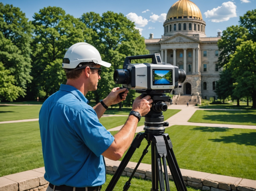
Precision and efficiency drive every successful AEC project. When you’re working with tight deadlines, complex geometries, and substantial financial investments, there’s no room for measurement errors or outdated documentation. Leading technology providers like Leica Geosystems have developed cutting-edge scanning hardware that delivers millimeter-level accuracy, while service experts such as Multivista bring the specialized expertise needed to transform raw scan data into actionable project intelligence.
The integration of 3D laser scanning solutions into AEC workflows eliminates guesswork, reduces costly rework, and accelerates project timelines. From hospitals with dense MEP systems to educational campuses requiring comprehensive documentation, this technology addresses the unique challenges facing modern construction professionals. Companies like Hexagon provide sophisticated software solutions that enhance quality control and deviation analysis capabilities, ensuring your projects maintain the highest standards of accuracy throughout their lifecycle.
Understanding 3D Laser Scanning Technology in the AEC Industry
3D laser scanning technology works by sending out millions of laser beams every second to measure distances and create highly detailed three-dimensional images of physical spaces. The scanner can rotate all the way around, capturing precise measurements of every surface within its range, creating millions of data points that together form complete digital records of existing conditions.
How the Technology Works in Practice
The scanning process begins when reality capture field specialists set up high-precision scanners at carefully chosen spots throughout a building or construction site. These experts know where to place the scanners to avoid shadows and ensure they capture complex architectural features completely. During each scan session, they gather detailed measurements of:
- Structural elements such as walls, columns, and beams
- MEP systems with intricate piping and ductwork configurations
- Surface conditions revealing deformations and irregularities
- Spatial relationships between different building components
The Critical Role of Point Clouds
The raw data collected transforms into point clouds – dense collections of three-dimensional coordinates that represent every measured surface. These point clouds serve as the foundation for all subsequent deliverables, providing millimeter-level accuracy that traditional measurement methods cannot match. You can think of point clouds as digital fingerprints of physical spaces, capturing reality with unmatched detail and precision.
Professional Expertise Behind Quality Results
A team of over 150 scanning professionals across seven countries brings extensive experience to every project. These specialists combine technical expertise with industry knowledge, understanding how different building types present unique challenges. Hospital environments require careful navigation around sensitive equipment, while educational campuses demand efficient workflows to minimize disruption to daily operations.
The quality of your scan data depends heavily on the expertise of these field specialists. They must consider environmental factors, equipment limitations, and project-specific requirements to deliver the accurate spatial representation your AEC project needs.
Core 3D Laser Scanning Services for AEC Projects
Professional 3D data capture services adapt to meet the unique requirements of every AEC project, regardless of scale or complexity. You can access comprehensive scanning solutions that accommodate single-room renovations, multi-building campuses, or large-scale industrial facilities. These customized services ensure you receive precisely the data formats and deliverables your project demands.
Scan to Plan: Converting Point Clouds to 2D Documentation
The scan to plan process transforms dense point cloud data into accurate 2D as-built CAD drawings that serve as the foundation for design and construction activities. Professional teams extract detailed architectural information from the 3D scan data to create:
- Floor plans with precise room dimensions and layout details
- Ceiling plans showing HVAC, lighting, and structural elements
- Building sections revealing internal configurations
- Roof plans documenting existing conditions
- Interior and exterior elevations capturing architectural features
- Site plans providing comprehensive property context
You receive these deliverables in industry-standard AutoCAD DWG and DXF formats, ensuring seamless integration with your existing design workflows and software platforms.
Scan to BIM: Creating Intelligent 3D Models
The scan to BIM process elevates your project documentation by transforming point cloud data into detailed BIM models that contain rich geometric and semantic information. Qualified architects and engineers extract as-built conditions from scan data to develop comprehensive digital representations of your facilities.
Architectural BIM packages include base models with detailed building geometry, while specialized add-on packages capture site-specific elements and landscape features. MEP scan to BIM services focus on mechanical, electrical, and plumbing systems, creating separate add-on packages for each discipline.
These intelligent models enable you to visualize complex building systems, detect potential conflicts, and make informed decisions throughout the project lifecycle. The detailed BIM models serve as living documents that support both construction activities and long-term facility management operations.
Advanced Analytical Solutions Enhancing Project Accuracy
Deviation analysis is a revolutionary advancement in construction quality control, allowing project teams to identify differences between design models and actual site conditions before they become expensive problems. This automated comparison process uses complex algorithms to highlight variations that could affect project timelines, budgets, and structural integrity.
Transforming Quality Assurance with Hexagon Software
Hexagon deviation analysis software transforms traditional quality assurance by providing automated detection capabilities that human inspectors might miss. You can visualize differences between your BIM design and reality through color-coded heat maps, making it easy to spot areas requiring immediate attention. The software automatically generates comprehensive reports that quantify deviations, allowing you to make data-driven decisions about necessary corrections.
Benefits Beyond Error Detection
The benefits extend beyond simple error detection:
- Early intervention: Catch discrepancies during construction phases when corrections are less expensive
- Stakeholder alignment: Share visual quality insights with all project participants
- Documentation accuracy: Ensure as-built models reflect true site conditions
- Risk mitigation: Prevent rework that could derail project schedules
Addressing Uneven Concrete Challenges
Floor flatness reports address one of construction’s most persistent challenges – uneven concrete slabs that cause downstream complications. Using precise laser scan data, these reports generate PDF heatmaps that visualize surface deformation and contours with millimeter accuracy. You can identify problematic areas before installing flooring, equipment, or other systems that require level surfaces.
Valuable Applications Across Industries
The applications prove particularly valuable in:
- Manufacturing facilities requiring precise machinery placement
- Logistics warehouses with automated storage systems
- High-rise buildings where floor irregularities compound across multiple levels
- Any concrete slab installation requiring validation against flatness specifications
Integrating Analytical Solutions for Comprehensive Quality Control
These analytical solutions integrate seamlessly with existing 3D Laser Scanning Solutions for the AEC Industry, providing you with comprehensive quality control capabilities that enhance project accuracy while reducing costly surprises during construction phases.
Sector-Specific Applications of 3D Laser Scanning in the AEC Industry
Different sectors within the AEC industry present unique challenges that require specialized approaches to 3D laser scanning.
Healthcare Facilities
Healthcare facilities represent some of the most complex environments for reality capture due to their intricate infrastructure requirements and dense MEP systems. Hospitals contain critical mechanical, electrical, and plumbing networks that must be documented with extreme precision to ensure patient safety and operational continuity.
The non-intrusive nature of 3D laser scanning becomes essential in healthcare settings where disrupting operations can have life-threatening consequences. Multivista’s scanning professionals can capture complete facility documentation without interfering with medical equipment or patient care areas. This approach enables accurate CAD drawings and BIM models that reflect the true complexity of hospital infrastructure, supporting renovation projects and facility management decisions.
Educational Institutions
Educational institutions benefit significantly from the georeferenced capabilities of point cloud data. Universities and school campuses often span multiple buildings across large areas, making traditional measurement methods time-consuming and error-prone. 3D laser scanning delivers comprehensive spatial documentation that links individual structures within a unified coordinate system.
Campus facility managers can visualize how each building relates to others, streamlining maintenance planning and infrastructure upgrades. The technology captures complex architectural features and building systems that would be nearly impossible to document accurately using conventional methods.
Commercial Buildings
Commercial buildings require precise as-built documentation to support both new development and modifications to existing structures. Outdated architectural plans frequently cause costly mistakes and project delays in commercial construction. 3D scanning provides accurate spatial data that reflects current site conditions, enabling developers to assess renovation impacts before committing resources.
Property owners can transform their commercial assets into information-rich digital resources, supporting multiple design options and stakeholder decision-making. The resulting point clouds, CAD drawings, and BIM models serve as reliable foundations for commercial property development and ongoing facility management operations.
Using Deliverables for Successful Projects and Facility Management
The wide range of deliverables produced by 3D laser scanning turns basic spatial data into valuable information that leads to project success. Here’s how these deliverables benefit both project execution and facility management:
1. Point Clouds: Creating a Digital Twin
Point clouds are the primary dataset obtained from 3D laser scanning. They consist of millions of precise measurement points that collectively represent your physical space in three dimensions.
- Benefits for Projects: Point clouds provide an accurate representation of existing conditions, enabling architects, engineers, and contractors to make informed design decisions and plan construction activities effectively. This data can be seamlessly imported into various software for further analysis and application.
- Benefits for Facility Management: Point clouds serve as a reliable reference for facility managers, allowing them to assess spaces, plan renovations, and optimize space utilization based on actual measurements.
2. CAD Drawings: Supporting Immediate Design Decisions
CAD drawings are traditional two-dimensional representations generated from point cloud data. These drawings are available in widely used formats such as AutoCAD DWG and DXF.
- Benefits for Projects: CAD drawings facilitate quick design reviews, coordination among various disciplines (e.g., architecture, structural engineering), and compliance with regulatory requirements.
- Benefits for Facility Management: CAD drawings provide facility managers with clear documentation of as-built conditions, making it easier to communicate renovation plans or modifications to contractors.
3. BIM Models: Enhancing Project Coordination
BIM models are intelligent three-dimensional representations created from point cloud data that include information about objects (e.g., walls, doors) and their relationships.
- Benefits for Projects: BIM models enable clash detection during the design phase, allowing teams to identify conflicts between different building systems (e.g., mechanical, electrical) before construction begins.
- Benefits for Facility Management: BIM models support facilities management activities by providing detailed information about building components (e.g., HVAC systems) necessary for maintenance planning or equipment replacement.
4. Immersive Imagery: Bridging Communication Gaps
Immersive imagery refers to interactive visual content derived from point cloud data that allows users to explore spaces virtually.
- Benefits for Projects: Immersive imagery helps stakeholders visualize design proposals or renovation concepts more effectively than traditional 2D drawings alone.
- Benefits for Facility Management: Immersive imagery enables remote collaboration among facility managers, tenants, and service providers by providing a common visual reference during discussions or decision-making processes.
5. As-Built Documentation: Supporting Ongoing Operations
As-built documentation consists of final records that capture the completed state of a project based on verified measurements taken after construction is finished.
- Benefits for Projects: As-built documentation serves as an official record of what was built, which can be important for future renovations or legal purposes.
- Benefits for Facility Management: As-built documentation provides facility managers with accurate information about building systems (e.g., plumbing layouts) necessary for maintenance tasks or compliance inspections.
By leveraging these deliverables throughout the project lifecycle—starting from design through construction and into ongoing operations—
Choosing a Trusted Partner for Your 3D Laser Scanning Needs
The success of your AEC project depends heavily on the expertise and reliability of your 3D laser scanning partner. You need a team that combines technical proficiency with proven field experience to deliver the precision your project demands.
1. Experience Matters
When selecting a scanning provider, experience is crucial. Teams with extensive backgrounds in reality capture understand the unique challenges each project presents. They know how to navigate complex environments, optimize scanning positions, and capture comprehensive data that meets your specific requirements. This expertise translates directly into higher quality deliverables and fewer project delays.
2. Cutting-Edge Hardware
Accurate 3D laser scanning solutions for the AEC industry rely on advanced technology. Leica Geosystems scanners are recognized as the industry standard for precision measurement. These instruments offer:
- Sub-millimeter accuracy for critical measurements
- High-speed data capture reducing site disruption
- Advanced range capabilities for large-scale projects
- Robust performance in challenging environmental conditions
3. Global Reach with Local Expertise
Ensuring timely and professional service for your project, regardless of its location, requires a combination of global reach and local expertise. Established providers with over 150 scanning professionals across multiple countries have teams that can quickly deploy to your site. This worldwide presence eliminates delays caused by equipment shipping and travel logistics.
Local teams possess knowledge of regional building practices, safety requirements, and regulatory standards. They can seamlessly coordinate with your existing project stakeholders and adapt to site-specific challenges. By merging global standards with regional knowledge, this localized approach guarantees consistent quality while respecting the dynamics of each individual project.
The right partner brings together advanced technology, skilled professionals, and responsive service delivery. You gain access to comprehensive scanning capabilities backed by proven methodologies and quality assurance processes that protect your project timeline and budget.
Contact Us for Professional 3D Laser Scanning Services Tailored to Your AEC Project Needs!
Are you ready to transform your AEC project with precise 3D Laser Scanning Solutions for the AEC Industry? You need a partner who understands the unique challenges of architecture, engineering, and construction projects. Get in touch with 3D Scan STL for Professional 3D Laser Scanning Services that deliver measurable results for your specific requirements.
Our team uses the latest Leica Geosystems technology and has extensive industry knowledge to offer:
- Customized scan-to-plan services for accurate as-built documentation
- Advanced BIM modeling with architectural and MEP packages
- Deviation analysis to identify costly errors before they affect your schedule
- Floor flatness reports ensuring concrete slab quality
Whether you’re working on a complex hospital renovation, educational campus expansion, or commercial development project, our reality capture specialists provide the exact data you need to make informed decisions.
Request your quote today to discover how our tailored 3D laser scanning solutions can enhance your project accuracy, decrease rework costs, and speed up your delivery timeline. Your next successful project begins with a conversation.