
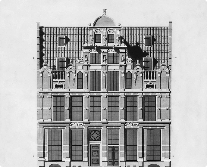
Scan to Plan - 2D CAD Drawing from As-Built Conditions
Scan to Plan Services
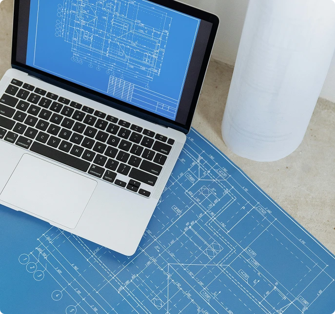
Scan to Plan Services – Accurate 2D Drawings from 3D Laser Scans have transformed how construction professionals document existing structures. When you’re working with as-built conditions, accuracy isn’t just important—it’s everything. Traditional measurement methods leave room for human error, missed details, and costly rework that can derail your project timeline and budget.
3D laser scanning changes this completely. You capture millions of data points in minutes, creating a comprehensive digital record of your site that serves as the foundation for precise 2D CAD drawings. This technology delivers millimeter-level accuracy while dramatically reducing the time you spend on-site collecting measurements.
The construction industry has embraced Scan to Plan services because they solve a critical problem: how do you create reliable documentation of complex existing conditions without spending weeks measuring every wall, pipe, and structural element? You use laser scanning to capture everything at once, then transform that data into the floor plans, elevations, and sections your team needs to move forward with confidence.
Understanding the Scan to Plan Process
The Scan to Plan process begins with deploying advanced 3D laser scanning technology on-site to capture comprehensive spatial data of existing structures. You position high-precision laser scanners at strategic locations throughout your facility, where they emit millions of laser pulses per second to measure distances to surrounding surfaces. This rapid data collection creates a digital replica of your physical space with exceptional detail.
How Scan to Plan Works
- Scanning: High-precision laser scanners are placed at key locations in the facility to capture detailed spatial data.
- Point Cloud Creation: The scanning process generates point cloud data, which consists of millions or billions of coordinate points representing every visible surface and feature in the scanned area.
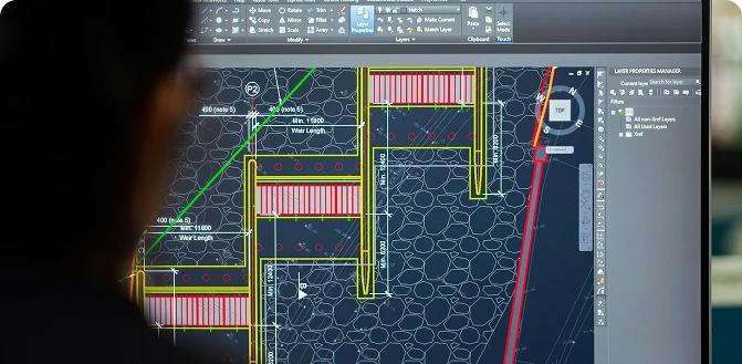
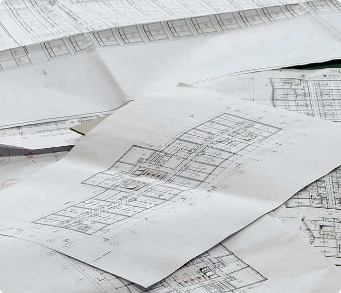
- CAD Linework Overlay: CAD technicians overlay vector-based lines and shapes onto cross-sections and views extracted from the point cloud to create usable 2D documentation.
Benefits of Scan to Plan
The advantages over traditional manual measurement methods are substantial:
- Speed: Data capture is completed in hours instead of days or weeks.
- Completeness: Every detail is captured in a single visit, eliminating the need for return trips due to missed measurements.
- Safety: Time spent in hazardous areas or at heights is reduced.
- Accuracy: Measurements maintain consistent precision throughout the entire dataset, avoiding cumulative errors from tape measures and manual recording.
Achieving High Precision and Time Efficiency with As-Built Drawings
Modern 3D laser scanners deliver accuracy levels of 1mm or better, setting a new standard for as-built documentation. You get measurements that capture every detail of your existing structure—from wall alignments to equipment positioning—with millimeter precision. This level of accuracy translates directly into as-built plans you can trust for critical design decisions, renovation planning, and compliance documentation.
The time-saving benefits reshape your project timelines dramatically. Where manual measurement methods might take weeks to document a complex facility, laser scanning completes the data capture in days or even hours. You’re looking at a 70-80% reduction in field time compared to traditional surveying approaches. Your team spends less time on-site with tape measures and more time analyzing data and making informed decisions.
This efficiency directly impacts your bottom line by reducing design errors and rework costs. When your as-built plans reflect true site conditions with millimeter precision, you eliminate the costly surprises that emerge during construction. Contractors work from drawings they can rely on, architects design additions that actually fit, and engineers specify equipment that integrates seamlessly with existing systems. The upfront investment in high-precision scanning pays for itself by preventing expensive field modifications and project delays.
The Step-by-Step Workflow of Scan to Plan Services
01
On-site Data Capture
On-site data capture forms the critical first phase of delivering Scan to Plan Services – Accurate 2D Drawings from 3D Laser Scans. You’ll find that experienced technicians position 3D laser scanners at strategic locations throughout your facility, capturing millions of data points per second. These professionals understand optimal scanner placement to minimize blind spots while maximizing coverage, ensuring comprehensive documentation of your space. The scanning process typically involves setting up multiple scan positions to capture complex geometries, tight spaces, and areas with varying elevations.
02
Scan Alignment
Once your site data returns to the processing team, scan alignment becomes the next crucial step. Technicians use specialized software to register individual scans into a unified coordinate system, creating a cohesive point cloud dataset. This registration process relies on common reference points between overlapping scans, achieving alignment accuracy that maintains the 1mm precision captured
in the field.
03
Data Trimming
Data trimming follows alignment, where processors remove extraneous information like temporary equipment, vehicles, or personnel captured during scanning. This cleanup phase ensures your final drawings focus on permanent structural elements and installed systems. You receive cleaner, more interpretable data that speeds up the CAD drawing generation phase.
04
Quality Analysis
The quality analysis stage involves rigorous checking protocols. Technicians verify scan completeness, confirm alignment accuracy, and validate that captured data meets project specifications. They identify any gaps requiring additional scanning or clarification before proceeding to CAD drawing generation. This systematic approach to quality control protects you from discovering missing information late in your project timeline, when corrections become expensive and time-consuming.
Methods for Generating Accurate 2D Drawings from Point Clouds
When you’re ready to transform your point cloud data into usable 2D drawings, you have two proven pathways to choose from. Each method delivers accurate results, but your project requirements will determine which approach serves you best.
Direct Point Cloud Slicing
Direct Point Cloud Slicing offers a streamlined route to your final deliverables. You slice through the point cloud at specific heights or angles, creating reference planes that guide your CAD linework drawing. Your drafting team overlays precise lines, arcs, and annotations directly onto these sliced views. This method excels when you need quick turnaround times and straightforward floor plans or elevations. You’ll find it particularly cost-effective for renovation projects where you’re documenting existing conditions without requiring extensive 3D modeling.
Scan-to-BIM
Scan-to-BIM takes a more comprehensive approach by building a complete 3D Building Information Model before extracting your 2D drawings. Using Autodesk Revit or similar BIM platforms, technicians model walls, floors, structural elements, MEP systems, and architectural features based on the point cloud data. Once your model is complete, you can export unlimited plan views, elevations, sections, and detail drawings with consistent accuracy across all outputs.
The scan-to-BIM workflow shines when you’re planning major renovations, coordinating complex MEP installations, or managing facilities that require ongoing updates. You gain a living digital twin of your facility that supports clash detection, quantity takeoffs, and future modifications. Your 2D drawings remain linked to the 3D model, ensuring any changes propagate automatically across all documentation.
You can also combine both methods—using direct slicing for simple areas while applying scan-to-BIM for complex zones requiring detailed coordination.
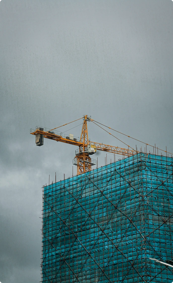
Applications of Scan to Plan in Industrial and Commercial Settings
Industrial plants face a persistent challenge: keeping documentation current. Equipment modifications, pipe rerouting, and structural changes happen regularly, yet your drawings rarely reflect these updates. You’re left with outdated plans that don’t match reality, creating safety risks and project delays.
Scan to Plan services solve this documentation gap by capturing what actually exists on your site. When you need accurate as-built layouts for a plant expansion or maintenance project, 3D laser scanning records every pipe, valve, and structural element exactly as installed. You get drawings that match your facility down to the millimeter.
P&ID drawings become particularly valuable in complex industrial environments. Traditional methods require technicians to manually trace piping systems through congested areas—a time-consuming process prone to errors. Laser scanning captures the entire piping network in hours, including:
- Pipe diameters and routing paths
- Valve locations and equipment connections
- Elevation changes and support structures
- Clearance measurements for maintenance access
Facility management teams use these accurate drawings for space planning, equipment upgrades, and regulatory compliance. When you’re planning a new production line or evaluating HVAC modifications, you need reliable spatial data. Scan to Plan delivers documentation you can trust, eliminating the guesswork that leads to costly field changes and project overruns.
Cost-Effectiveness and Collaboration Benefits of Using 3D Scan STL for Scan to Plan Services
3D Scan STL expertise transforms complex scanning projects into streamlined deliverables that save you both time and money. With years of specialized experience in delivering Scan to Plan Services – Accurate 2D Drawings from 3D Laser Scans, the team brings proven methodologies that consistently produce exceptional results across diverse project types.
The on-site data capture process happens quickly and with minimal disruption to your operations. Skilled technicians arrive equipped with state-of-the-art scanning equipment and complete comprehensive site surveys in a fraction of the time traditional measurement methods require. You won’t experience extended downtime or workflow interruptions—the scanning process is designed to be painless
and efficient.
Behind the scenes, robust data processing techniques ensure your final deliverables meet the highest standards. The workflow includes:
- Precise scan alignment that merges multiple scan positions into cohesive, unified datasets
- Rigorous quality assurance protocols that verify accuracy at every processing stage
- Systematic data cleaning that removes extraneous information while preserving critical details
- Multi-level review processes conducted by experienced CAD technicians
This comprehensive approach to quality control means you receive drawings you can trust for critical decision-making. The investment in professional Scan to Plan services pays dividends through reduced design conflicts, fewer change orders, and accelerated project timelines. When your project team works from accurate as-built documentation, collaboration becomes seamless—architects, engineers, and contractors reference the same reliable spatial data, eliminating costly miscommunications and coordination errors.

Conclusion
Advanced scanning technologies are changing the way you document existing conditions. Scan to Plan Services – Accurate 2D Drawings from 3D Laser Scans provide the precision and efficiency your projects need. You get millimeter-level accuracy, reduce expensive rework, and speed up project timelines with proven workflows.
Want to see these benefits for yourself? Contact 3D Scan STL for a quote or consultation on your next project. Our experienced technicians and reliable processing methods guarantee top-notch results that enhance decision-making and teamwork throughout your entire team. Switching from traditional methods to laser scanning isn’t just an improvement—it’s a competitive edge you can’t afford to overlook.
Frequently Asked Questions
What are Scan to Plan Services and why are they important in the construction industry?
Terrestrial Laser Scanning (TLS) is a ground-based LiDAR technology that rapidly captures millions of precise 3D data points to create highly accurate 3D models, photorealistic images, and detailed real-time measurements of physical objects, structures, and environments. It works by spinning a laser to measure distances and angles to surfaces, producing dense “point clouds” for applications like construction, forensics, heritage conservation, and infrastructure inspection.
How does the Scan to Plan process utilize 3D laser scanning and point cloud data?
TLS captures millions of data points in a single scan, delivering highly accurate and precise measurements. The latest devices ensure +-1mm accuracy of the single scan, this level of detail is invaluable for creating as-built models, conducting topographic surveys, and ensuring design accuracy. It eliminates human error, and the measurement inaccuracies are often associated with traditional surveying methods. TLS captures millions of data points in a single scan, providing highly accurate and precise measurements. The latest devices ensure +/-1mm accuracy of each scan, and this level of detail is invaluable for creating as-built models, conducting topographic surveys, and ensuring design precision.
What level of precision can be achieved with modern Scan to Plan services?
Yes, we offer industrial as-built services, documenting final dimensions, locations of equipment, pipes, conduits, and changes from original plans for warehouses, manufacturing, and large facilities. These deliverables (drawings/models) ensure compliance, facilitate maintenance, and aid future renovations.
Can you describe the typical workflow involved in delivering Scan to Plan Services?
Yes, we offer industrial as-built services, documenting final dimensions, locations of equipment, pipes, conduits, and changes from original plans for warehouses, manufacturing, and large facilities. These deliverables (drawings/models) ensure compliance, facilitate maintenance, and aid future renovations.
What methods are used to generate accurate 2D drawings from point clouds in Scan to Plan?
Yes, we offer industrial as-built services, documenting final dimensions, locations of equipment, pipes, conduits, and changes from original plans for warehouses, manufacturing, and large facilities. These deliverables (drawings/models) ensure compliance, facilitate maintenance, and aid future renovations.
How do Scan to Plan Services benefit industrial and commercial facility management?
Yes, we offer industrial as-built services, documenting final dimensions, locations of equipment, pipes, conduits, and changes from original plans for warehouses, manufacturing, and large facilities. These deliverables (drawings/models) ensure compliance, facilitate maintenance, and aid future renovations.
Get Started with Scan to Plan Services
If you need accurate existing‑conditions data for your building project, our Building 3D Laser Scanning services provide the clarity and precision your team needs.
Contact us today to discuss your project scope, building size, required accuracy, and desired deliverables—and we’ll help you move forward with confidence.