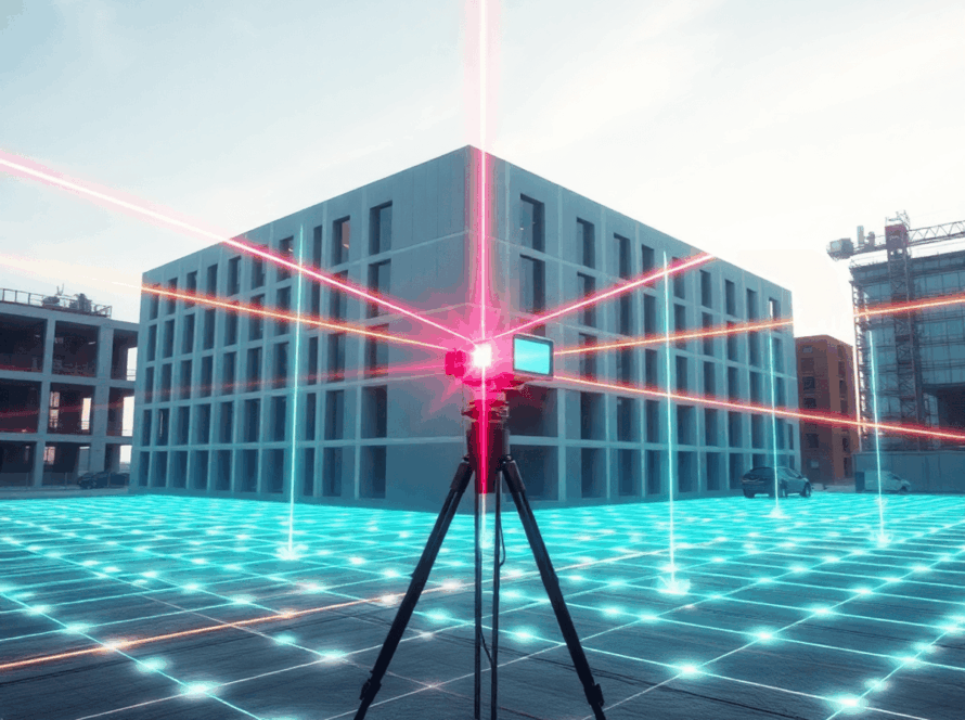
Terrestrial 3D scanning has changed the way professionals capture and analyze physical spaces, allowing for unprecedented precision. This advanced technology uses methods like laser scanning and structured light to create detailed digital representations of real-world environments, turning raw spatial data into useful information.

How Terrestrial 3D Scanning Works
The technology works by projecting laser beams or structured light patterns onto surfaces, measuring distances with millimeter accuracy to generate comprehensive point clouds. These digital datasets capture every detail of a structure or environment, from architectural features to complex industrial installations.
Industries Using Terrestrial 3D Scanning
Modern industries have embraced terrestrial scanning as an essential tool for project success:
- Architecture firms rely on 3D terrestrial scanning services to document existing buildings for renovation projects, ensuring accurate as-built drawings that eliminate costly surprises during construction.
- Construction teams use this technology for site analysis, progress monitoring, and quality control throughout project lifecycles.
- Engineering professionals depend on terrestrial 3D scanning for infrastructure assessments, deformation studies, and precise measurements of complex structures.
- Manufacturing facilities utilize these services for equipment positioning, facility planning, and maintenance documentation.
- Historical preservation specialists employ the technology to create permanent digital records of culturally significant structures.
You’ll find terrestrial 3D scanning services becoming increasingly vital as industries prioritize accuracy, efficiency, and digital transformation in their operations. The technology bridges the gap between physical reality and digital workflows, enabling better decision-making across diverse applications.
How Terrestrial 3D Scanning Works
Laser scanning technology operates on the fundamental principle of time-of-flight measurement. The scanner emits rapid pulses of laser light—often millions per second—toward target surfaces. When these laser beams strike objects, they reflect back to the scanner’s sensor. The device calculates precise distances by measuring the time each pulse takes to return, creating incredibly accurate spatial measurements down to millimeter precision.
Structured light scanning takes a different approach, projecting known patterns of light onto surfaces and analyzing how these patterns deform when they encounter three-dimensional objects. This method excels in capturing fine surface details and textures that complement laser-based measurements.
The Point Cloud Generation Process
The spatial data capture process transforms these distance measurements into comprehensive digital representations:
- Data Collection: Scanners capture thousands of measurement points per second from multiple positions
- Registration: Software aligns overlapping scans to create a unified coordinate system
- Processing: Raw measurements become organized point cloud data containing millions of precisely positioned points
- Quality Control: Automated and manual checks ensure data accuracy and completeness
Converting Point Clouds to Usable Formats
Raw point cloud data serves as the foundation for various digital deliverables that meet specific project requirements:
2D CAD Drawings – Engineers extract floor plans, elevations, and cross-sections directly from point clouds, ensuring as-built accuracy for renovation and construction projects.
3D Models – Mesh generation software converts point clouds into solid surface models suitable for visualization, analysis, and manufacturing applications.
BIM Files – Building Information Modeling software integrates point cloud data to create intelligent 3D models containing geometric and semantic information about building components.
Digital Twins – Advanced processing creates dynamic digital replicas that mirror real-world conditions, enabling ongoing monitoring and predictive analysis throughout a structure’s lifecycle.
This transformation from raw laser measurements to actionable digital assets enables professionals across industries to make informed decisions based on precise spatial information.
Applications of Terrestrial 3D Scanning Services
Architectural Scanning
Architectural scanning transforms how building professionals approach renovation and documentation projects. You can capture existing structures with millimeter precision, creating comprehensive as-built documentation that eliminates guesswork during renovation planning. Historic buildings, complex facades, and intricate interior spaces become digitally preserved, allowing architects to design modifications with complete confidence in their spatial understanding.
Engineering and Construction
Engineering and construction teams leverage terrestrial scanning for critical site analysis and ongoing monitoring. You receive detailed topographical data that informs foundation planning, while deformation studies track structural movement over time. Construction sites benefit from progress monitoring, clash detection, and quality control verification against original design specifications.
Industrial Metrology
Industrial metrology applications span manufacturing facilities and oil & gas installations. Manufacturing plants use scanning services to document equipment layouts, plan facility expansions, and conduct reverse engineering projects. Oil refineries and chemical plants require precise documentation for safety compliance, maintenance planning, and asset management. You gain accurate measurements of piping systems, storage tanks, and complex industrial equipment configurations.
Historical Preservation
Historical preservation projects depend on terrestrial scanning to create permanent digital records of culturally significant structures. Museums, monuments, and archaeological sites receive detailed documentation that supports restoration efforts and research initiatives. You preserve irreplaceable heritage assets in digital formats that withstand time and environmental threats.
Infrastructure Assessment
Infrastructure assessment covers bridges, tunnels, dams, and transportation networks. Civil engineers use scanning data to evaluate structural integrity, plan maintenance schedules, and design upgrades to existing infrastructure. Highway departments document roadway conditions, while utility companies map underground and overhead systems with unprecedented accuracy.
Each application demonstrates how terrestrial 3D scanning services deliver precise spatial data that traditional measurement methods cannot match. You access comprehensive digital representations that support informed decision-making across diverse project requirements.
Benefits of Using Terrestrial 3D Scanning Services
Terrestrial 3D Scanning transforms how you approach complex projects by delivering accurate baseline data that eliminates guesswork and reduces costly mistakes. Traditional measurement methods often introduce human error, but laser scanning technology captures millions of data points with millimeter-level precision. You can trust this level of accuracy to minimize design conflicts and construction errors that typically plague projects relying on conventional surveying techniques.
1. Faster Project Timelines
Faster project timelines become achievable when you leverage the speed of modern scanning equipment. A single scanning session can capture comprehensive spatial data in hours rather than the days or weeks required for manual measurements. This acceleration allows your team to move quickly from data collection to analysis and design phases, significantly reducing overall project duration.
2. Improved Communication
Improved communication emerges naturally when stakeholders can visualize precise 3D representations of existing conditions. You can share detailed point clouds, cross-sections, and measurements that speak a universal language across disciplines. Engineers, architects, and project managers can collaborate more effectively when everyone works from the same accurate spatial reference.
3. Digital Transformation
Digital transformation initiatives gain momentum through seamless integration with BIM models and digital twins. The rich data sets from terrestrial scanning feed directly into your digital workflows, creating comprehensive virtual representations that support decision-making throughout project lifecycles. You position your organization at the forefront of industry innovation by embracing these advanced visualization and analysis capabilities.
Why Choose 3D Scan STL for Your Terrestrial 3D Scanning Needs?
3D Scan STL, a leader in terrestrial scanning in the Midwest, brings unmatched expertise to every project across the region. You gain access to cutting-edge technology and seasoned professionals who understand the unique challenges facing Midwest industries. Our team has successfully completed hundreds of scanning projects, from historic building documentation in downtown St. Louis to complex industrial facility assessments throughout Missouri and Illinois.
Precision drives every aspect of our work. You receive millimeter-accurate measurements backed by rigorous quality control processes. Our technicians undergo continuous training on the latest scanning equipment and software, ensuring your project data meets the highest industry standards. Each scan undergoes multiple validation checks before delivery, giving you confidence in the results.
Professional terrestrial scanning services extend across multiple industries through our comprehensive service portfolio:
- Architectural documentation: for renovation and restoration projects
- Construction site monitoring: and progress tracking
- Industrial facility mapping: for maintenance planning
- Historical preservation: scanning for cultural heritage sites
- Infrastructure assessment: for bridges, tunnels, and civil works
You work directly with specialists who understand your industry’s specific requirements. Our flexible approach adapts to project timelines, site constraints, and budget considerations. Whether you need rapid turnaround for emergency assessments or detailed long-term documentation, our team delivers solutions tailored to your exact specifications.
Contact Us for Professional Terrestrial Scanning Services Today!
Ready to transform your project with cutting-edge Terrestrial 3D Scanning technology? 3D Scan STL stands ready to deliver the precise spatial data capture your project demands. Our expert team brings years of specialized experience to every scanning challenge, ensuring you receive accurate, actionable results that drive project success.
Partner with us to unlock the full potential of your next initiative:
- Precision-driven scanning solutions tailored to your specific requirements
- Expert consultation to determine the optimal scanning approach for your project
- Rapid turnaround times without compromising quality standards
Don’t let inaccurate measurements or incomplete documentation derail your project timeline. Contact professional terrestrial scanning services at 3D Scan STL today and discover how our advanced scanning capabilities can elevate your project outcomes. Your success is our mission.